ANAV
ANAV is an intelligent autonomous navigation architecture built to perform spatial localization and geometric environmental mapping within unstructured, completely unknown territories.
Project Overview
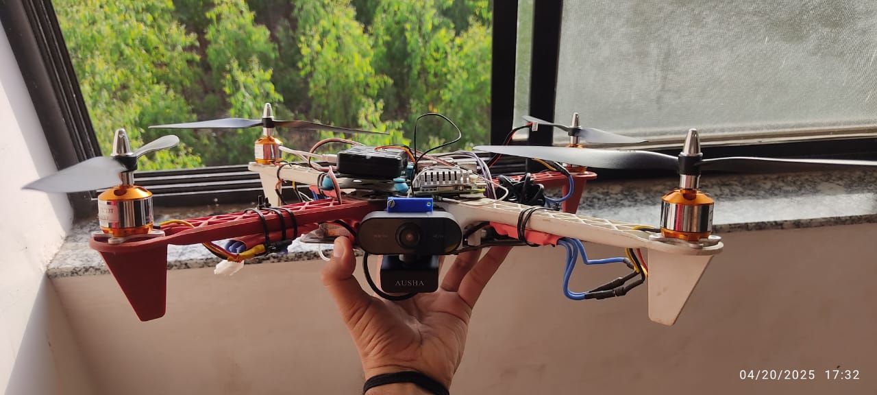
The system continuously processes visual information from onboard sensors to estimate its position and construct a map of the surrounding environment. As the vehicle explores, it identifies navigable regions, avoids obstacles, and updates the generated map in real time. The resulting visualization provides operators with valuable situational awareness while enabling autonomous movement through previously unexplored areas.
Problem Statement
Navigation in unknown or GPS-denied environments presents significant challenges for autonomous systems. Traditional navigation methods often rely on pre-existing maps or external positioning systems, limiting their effectiveness in dynamic and unstructured settings. There is a need for intelligent systems capable of building their own understanding of the environment while navigating safely and efficiently.
Proposed Solution
ANAV utilizes visual SLAM algorithms to simultaneously estimate vehicle position and generate an environmental map. The navigation framework combines localization, obstacle detection, and path planning modules to enable autonomous exploration. The generated maps can be visualized in real time, providing both operational insight and a foundation for future mission planning.
Key Features
- Autonomous navigation in unknown environments
- Real-time localization and mapping
- Visual SLAM-based environment reconstruction
- Obstacle detection and avoidance
- Path planning and trajectory generation
- Live environment visualization and monitoring
Technologies Used
- ORB-SLAM3 Framework
- ROS (Robot Operating System)
- Computer Vision and Image Processing
- Python and C++
- Path Planning Algorithms
- Real-Time Mapping and Localization
Results & Achievements
Successfully achieved full spatial loop closure and map building outputs across simulated planetary testing fields, guaranteeing robust telemetry feedback tracks.